The 4-Day Rwenzori Trek to John Matte Hut on the Central Circuit trail/route is the finest 4-day Rwenzori trekking expedition available in Rwenzori Mountains National Park for guests who want to penetrate deeply into the mountain’s ecology without the technical requirements of a glacier crossing or a summit push. John Matte Hut at 3,414 metres above sea level sits in the upper Bujuku Valley — named for one of the Rwenzori’s greatest Bakonzo guides — at the precise altitude where the Hagenia-Hypericum woodland gives way to the lower margins of the Erica heath, and where, on a clear morning, Mount Stanley (5,109 m), Mount Speke (4,890 m), and the Rwenzori’s upper massifs become visible in a panorama that changes the scale of everything you thought you understood about this mountain. To stand at John Matte and look up at Margherita Peak above the cloud is to understand, viscerally, why the Duke of Abruzzi called this place the most extraordinary mountain environment he had ever encountered — and he had climbed extensively in the Alps, the Himalayas, and the Arctic.
What distinguishes the 4 days Rwenzori trek to John Matte from its three-day equivalent is a gift that all of the Rwenzori’s finest treks share: the gift of the extra day. Day 3 on the 4-day Rwenzori trek to John Matte Camp is a full exploration day at John Matte Hut — a day for climbing toward the upper Bujuku Valley, for watching the giant Lobelia plants open their leaves in the morning sun, for sitting at the hut’s edge in the evening as the cloud builds around the peaks above, and for understanding, in the unhurried way that only time in a wild place provides, what Africa’s most biologically complex mountain environment actually is.
At Gorilla Safaris, this trek is arranged as a fully private expedition. Your own certified mountain guide. Your own dedicated porter team. Your own pace across all four days — shaped around your group’s particular interests, fitness, and appetite for exploration. For families with older children ready for a genuine high-altitude mountain immersion, for couples seeking a shared physical achievement in a landscape of extraordinary beauty, for solo travellers who want expert company and no logistical burden, and for groups of friends for whom the Rwenzori’s singular strangeness is precisely the point — this four-day journey into the heart of the Mountains of the Moon was built around people exactly like you. Many guests precede it with a gorilla trekking safari in Bwindi Impenetrable National Park — an encounter with mountain gorillas in their natural habitat that pairs, in terms of raw wildlife intensity, perfectly with what the Rwenzori’s forests and high camps then provide.
John Matte Hut — The Gateway to the Rwenzori’s Upper World
Why John Matte is the Central Circuit’s Most Important Camp
John Matte Hut sits at 3,414 metres above sea level in the upper Bujuku Valley — the main corridor of the Rwenzori Central Circuit and the route that all Margherita Peak summit programmes follow. The hut is named for John Matte, one of the most celebrated Bakonzo mountain guides in the Rwenzori’s trekking history: a man whose knowledge of the Central Circuit terrain was so comprehensive and so reliable that his name on a camp is as appropriate a memorial as the mountain can provide. The camp sits at the junction between the Hagenia-Hypericum woodland below and the Erica heath above — a position that makes it simultaneously one of the most botanically interesting overnight points on the circuit and one of the most panoramically rewarding, with views up the valley toward Mount Stanley and Mount Speke that no lower camp can provide.
John Matte Hut is the destination for guests who want to experience the Rwenzori’s genuinely alpine character — the giant plants, the high bog, the cold clear air, the proximity of permanent snow on the massifs above — without the technical requirements of glacier travel and summit mountaineering. The 4-day Rwenzori trek to John Matte is perfectly calibrated for this ambition: two days of ascent through the mountain’s lower and middle zones, a full exploration day at the hut, and a single long descent day. It is the most complete short-trek programe on the Central Circuit trail and the one that, in the experience of Gorilla Safaris guides, produces the deepest and most lasting engagement with the Rwenzori’s extraordinary ecology.
The Kurt Schafer Bridge and the Central Circuit’s Defining Feature
The approach to John Matte from Nyabitaba crosses the Kurt Schafer Bridge — a suspension bridge spanning the confluence of the Mubuku and Bujuku rivers in the valley below Nyabitaba Camp. Named for a Swiss mountaineer who contributed to the development of the Central Circuit’s infrastructure, the bridge is one of the most photographed and most symbolically significant points on the trek: the crossing from one side of the valley to the other marks the passage from the lower forest into the upper circuit, and the views from its span — the two rivers meeting in a forested gorge below, the valley walls rising steeply on both sides toward cloud-covered peaks — are among the most dramatic on the entire 4 days Rwenzori trekking to John Matte Hut/Camp.
The Six Rwenzori Mountains — Understanding What You See from John Matte
The panorama from John Matte Hut’s upper clearing on a clear morning is the most compelling argument for the 4 Days Rwenzori trek to John Matte over any shorter alternative. The six major massifs of the Rwenzori range are arranged around the upper Bujuku Valley in a configuration that reveals itself progressively as the cloud lifts: Mount Stanley (5,109 m) — Africa’s third highest summit, carrying the Margherita Peak, Alexandra, and Albert peaks above the Elena Glacier — dominates the head of the valley.
Mount Speke (4,890 m) carries the Vittorio Emanuele Peak visible on the valley’s eastern side. Mount Baker (4,843 m) with its Edward Peak, Mount Emin (4,798 m), Mount Gessi (4,715 m), and Mount Luigi di Savoia (4,627 m) complete the range visible from the upper circuit. Standing at John Matte in the early morning and watching these summits emerge from the cloud — briefly, incompletely, with the particular drama that the Rwenzori’s weather systems orchestrate rather than deliver — is the experience that defines the 4 days Rwenzori trek to John Matte’s third day.
Getting to Nyakalengija: The Central Circuit Gateway
From Kampala or Entebbe by Road
The Nyakalengija trailhead sits approximately 5 kilometres from Kasese town in western Uganda, roughly 370 kilometres west of Kampala on the main western highway. The drive from Kampala or Entebbe takes five to six hours — a journey through the highlands of southwestern Uganda, the rift valley escarpment above Kasese, and the final approach to Nyakalengija on a red-earth road that narrows as the Mubuku Valley closes around it and the mountain’s ridgelines grow more insistent overhead. Your dedicated Gorilla Safaris vehicle handles the complete transfer, with a planned comfort stop and lunch en route. Most guests overnight in Kasese the night before the trek begins, arriving at the trailhead in the morning rested and ready rather than road-worn.
By Domestic Flight to Kasese
Uganda Airlines operates domestic flights between Entebbe International Airport and Kasese Aerodrome, reducing the journey to under an hour in the air. Your dedicated vehicle meets the flight on arrival and completes the short transfer to Nyakalengija. This option is particularly convenient for guests whose Uganda itinerary begins with a Rwanda gorilla trekking safari — crossing from Kigali to Entebbe by air before flying directly to Kasese and arriving at the Rwenzori trailhead without a full day consumed by road travel.
The Bwindi to Rwenzori Transfer
The most popular itinerary pairing for the John Matte Hut trek combines it with gorilla trekking in Bwindi Impenetrable National Park. Bwindi’s primary sectors at Buhoma and Rushaga sit approximately three hours from Kasese by road — a transfer that passes through some of Uganda’s most beautiful highland scenery and along the northern boundary of Queen Elizabeth National Park. Many guests incorporate a morning game drive in Queen Elizabeth or a Kazinga Channel boat cruise into the transfer day, arriving in Kasese in the afternoon for a comfortable overnight before the Day 1 trailhead start. All transitions are arranged and managed by the Gorilla Safaris team as a single, seamlessly coordinated private itinerary.
4-Day John Matte Hut Trek — Itinerary at a Glance
Your four days on the Central Circuit at a glance. The full immersive narrative follows below.
- Day 1 — Nyakalengija to Nyabitaba Camp: Transfer from Kasese to Nyakalengija UWA headquarters | Permits and ranger briefing | Trek through lower montane forest | Mubuku River crossing | Bamboo zone | Blue monkeys, Colobus and Rwenzori Turaco | Overnight at Nyabitaba Camp (2,651 m)
- Day 2 — Nyabitaba to John Matte Hut: Kurt Schafer Bridge crossing | Upper forest ascent | Bamboo and Hagenia-Hypericum woodland | Nyamuleju rock shelter viewpoint | First views of Mount Stanley and Mount Speke | Bigo Bog margins | Giant Senecio and giant Lobelia | Overnight at John Matte Hut (3,414 m)
- Day 3 — Full Exploration Day at John Matte Hut: Morning views of Stanley and Speke massifs | Guided walk into upper Bujuku Valley | Giant Senecio forest | Bujuku Lake approach option | Birdlife in the Erica zone | Afternoon at leisure | Second overnight at John Matte Hut
- Day 4 — John Matte Hut — Full Descent to Nyakalengija: Nyabitaba rest stop | Descent through Hagenia, bamboo and lower montane forest | Return to Nyakalengija trailhead | Trekking certificate | Onward transfer to Kasese
Total Distance: Approximately 38–44 km across all 4 days
Highest Point: John Matte Hut, 3,414 m above sea level
Total Elevation Gain: Approximately 1,764 m from trailhead to John Matte Hut
Difficulty: Moderate to challenging — suitable for fit adults and active children aged 12+; no technical mountaineering required
Trek Style: Fully private, guide-led, porter-supported — your pace, your programme, your mountain
Day 1 — The Forest Opens: Nyakalengija to Nyabitaba Camp (2,651 m)
Arrival at the Trailhead
The drive from Kasese to Nyakalengija follows a road that narrows progressively and purposefully, the valley walls drawing together overhead, the Rwenzori’s forested ridgelines appearing in the spaces between banana groves and Bakonzo homesteads before the last cultivated field gives way to the park boundary.
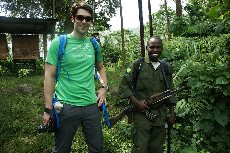
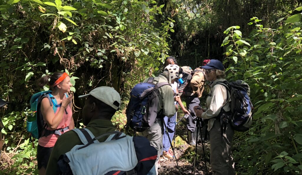
Your dedicated vehicle arrives at the Uganda Wildlife Authority headquarters where your private guide handles the registration, briefing, and permit confirmation with quiet efficiency. The ranger escort who will accompany the group for all four days on the trail is introduced. The mountain register is signed. And then the wooden bridge over the Mubuku River is crossed, and the forest begins.
The Lower Montane Forest — Life in Every Layer
The lower montane forest of the Rwenzori Central Circuit trail is one of the most biologically layered environments in Africa: a system of such ecological complexity that the standard vocabulary of forest description — canopy, understorey, forest floor — barely begins to account for what is actually happening in each vertical zone. Giant Podocarpus trees provide the upper structure. Beneath them, Macaranga and tree ferns form a mid-storey. Below that, wild ginger, Mimulopsis, and climbing plants colonise every available surface. And below that, the forest floor — soft with decades of leaf litter, traversed by roots that surface and submerge in patterns that demand constant attention from the boots — supports an extraordinary diversity of fungi, mosses, and small vertebrates that the casual observer might miss entirely and the patient guide can reveal in abundance.
The cicadas are the forest’s most insistent presence in the sensory experience of Day 1 — a sustained, layered wall of sound that fills the acoustic space completely and takes twenty minutes to cease being a thing you consciously register. Once it recedes into the background of the forest’s general voice, subtler sounds emerge: the Mubuku River somewhere below the trail, the hollow percussion of a woodpecker in the mid-canopy, and — if the forest is in a generous mood — the deep, resonant croaking of the Rwenzori Turaco, that most vivid of birds, heard before it is seen, its crimson wing-flash a visual shock against the green when it finally moves through a gap in the canopy.
Blue monkeys — Cercopithecus mitis — are reliable companions in the lower forest, their composure in the canopy above the trail the composure of animals who are entirely accustomed to the occasional group of humans moving through their territory and entirely unimpressed by it. Black-and-white Colobus monkeys are less certain but regularly present, their acrobatic movement through the upper canopy generating the crashing sound of large mammals in trees that seems wildly disproportionate to their elegance. Your guide reads the canopy overhead with the practiced ease of someone for whom primate location is a language as natural as English, pointing upward before most of the group has registered that anything is moving.
The Bamboo Zone and the Ridge to Nyabitaba
The trail climbs steadily, crossing several small streams on log bridges, before entering the bamboo zone — that transitional world of hollow sound and diffuse, greenish light where the forest character shifts from the complex enclosure of the lower montane to something more open and more rhythmic. The bamboo’s percussion is the companion of the final section of the Day 1 ascent: stem against stem in the breeze, a sound that is both random and oddly musical, an acoustic environment as specific to this altitude band as birdsong is to any other.
The Nyabitaba ridge appears without dramatic announcement — the bamboo thinning, the trail levelling briefly, and then the camp huts visible ahead through the last of the cane. Nyabitaba Camp sits at 2,651 metres on a ridge where the Mubuku and Bujuku rivers meet in the valley below — a confluence visible through the trees on clear afternoons, the twin rivers catching the last light before the valley shadow arrives. The camp’s mountain huts are functional and well-maintained, and the cook team — who have moved ahead of the trekking group to establish the camp — has a hot dinner ready. The day has covered approximately 9 Kilometres and gained 1,005 metres. The evening at Nyabitaba is one of those satisfying simplifications that physical effort and altitude produce: the meal, the warmth, the early dark, the sound of the valley below, and a sleep that arrives without delay.
Overnight: Nyabitaba Camp (2,651 m) — twin-share mountain huts, sleeping mats and blankets provided. Hot dinner and full breakfast prepared by your dedicated camp cook. Drinking water from mountain sources, purified and provided throughout.
Day 2 — The Botanical Ascent: Nyabitaba to John Matte Hut (3,414 m)
The Kurt Schafer Bridge — The Circuit’s Symbolic Threshold
Day 2 begins with a descent from Nyabitaba Camp down to the Kurt Schafer Bridge in the valley below — a counter-intuitive opening to what will be the programme’s most demanding day of ascent, but one that announces the Central Circuit’s particular approach to topography. The valley floor at the bridge is where the Mubuku and Bujuku rivers converge in a roar of cold, glacier-fed water over dark rock, the forest pressing in on both sides and the valley walls rising steeply ahead. The bridge itself — named for a Swiss mountaineer whose contribution to the circuit’s development is commemorated here — is a single-span crossing that gives the climber their first unobstructed view up the Bujuku Valley: a forested corridor narrowing toward cloud-covered peaks that are, on most mornings, entirely invisible behind their permanent weather system.
The crossing of the Kurt Schafer Bridge marks the symbolic and psychological threshold of the Central Circuit. On the near side: the lower forest, the day world, the accessible. On the far side: the upper circuit, the world of giant plants and high bog and the permanent cloud that gives the Rwenzori its character and its mystery. The transition does not happen immediately — the forest on the far side of the bridge is still forest, still inhabited by the same birds and the same mosses — but the bridge is where the mountain becomes something different in intention.
The Upper Forest — Hagenia and Hypericum
The ascent from the Kurt Schafer Bridge climbs through the middle montane zone before entering the Hagenia-Hypericum woodland — the most botanically distinctive zone of the Rwenzori Central Circuit and the environment that most trekkers, on their first encounter, describe as the single most beautiful thing they have seen on the trail. Hagenia trees grow in forms of extraordinary variety: massive, gnarled trunks draped from base to branch-tip in old man’s beard lichen, their horizontally extending branches producing dense, complex canopy structures that make the forest feel simultaneously enclosed and three-dimensional in a way that the lower forest’s vertical architecture does not. Hypericum trees — the African St John’s Wort grown to the proportions of a proper forest tree — add their small yellow flowers wherever the canopy opens, creating the occasional explosion of warm colour in a landscape otherwise defined by greens and silvers.
The moisture in the Hagenia zone is something you feel on the skin before you see it on the vegetation. The Rwenzori’s cloud system settles into the upper valley with a particular density here — not rain, exactly, but a sustained dampness that saturates every surface and gives the old man’s beard lichen hanging from the Hagenia branches a quality of movement, swaying in the gentlest air currents as if the forest is slowly breathing. The waterproofing in your pack earns its place from this point on the circuit, and the trekking poles that felt optional in the lower forest become structurally important on the rooted, often slippery trail through the Hagenia.
The Nyamuleju Rock Shelter and the First Summit Views
At approximately 3,000 metres, the trail passes the Nyamuleju rock shelter — a natural overhang that has served as a rest stop and emergency shelter for Central Circuit trail trekkers for as long as the route has existed. It is here, on clear days, that the cloud above the upper Bujuku Valley first breaks sufficiently to reveal what lies above: the great peaks of the Rwenzori’s upper massifs, their permanent snow and ice briefly visible above the cloud layer in a display that produces, in most first-time observers, a complete recalibration of what they thought they were walking toward. Mount Stanley’s south-eastern flank, with the glaciated summit ridge visible on the clearest mornings, appears from the Nyamuleju viewpoint at a scale that makes the hut below the summit — Elena Hut at 4,541 metres — seem impossibly high. Mount Speke shows its upper profile to the east. The Rwenzori’s true scale, concealed by the forest below, declares itself here without reservation.
Giant Plants and the Approach to John Matte
Above Nyamuleju, the trail enters the zone of the giant Senecio — Senecio adnivalis — those extraordinary succulent trees of the Rwenzori’s upper altitudes, their rosettes of large leaves spiraling with mathematical precision from thick central stems, their dead lower leaves forming insulating skirts around the growing point. The first time a trekker encounters a giant Senecio in fog — its form emerging from the mist like something from a fever dream about Jurassic ecosystems — is a moment that the photographs they take will fail to adequately reproduce, not because their cameras are insufficient but because the photograph cannot carry the cold, the silence, and the slow revelation of the thing emerging from the cloud. The giant Lobelia accompanies the Senecio in the wetter sections of the upper approach — a plant of tall, spike-leaved architecture that closes its leaves around the growing point each night against the freezing temperature and reopens them at dawn, a movement visible in the early morning to any observer patient enough to watch.
The Bigo Bog — a section of the upper Bujuku Valley where the sphagnum moss and sedge have accumulated to depths that make the ground elastic and occasionally treacherous underfoot — is the Day 2 ascent’s most visually spectacular and most navigationally demanding feature. The bog extends across the valley floor in a carpet of saturated green, threaded with the wooden boardwalks that provide the only reliable footing across its widest sections. The guide’s route knowledge is most critical here: what appears to be solid ground regularly yields unexpectedly, and the line through the bog that minimises both difficulty and ecological impact requires genuine familiarity with the terrain through different seasons and conditions. On each side of the boardwalk, the bog vegetation — sphagnum cushions, sedge tussocks, flowering herbs, and the tracks of giant forest hog that are the Bigo’s most regular large mammal residents — is a botanical garden that no gardener could have planned.
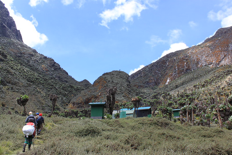
John Matte Hut appears at the far end of the bog crossing and the final climb of the day — a cluster of mountain accommodation huts at 3,414 metres, set in a clearing that offers the first open, unobstructed view up the Bujuku Valley toward the high peaks. The relief of arrival after a seven-to-eight-hour day through the botanical zones of the Central Circuit is genuine and physical. The guide’s pre-dinner camp assessment — a quiet check of each group member’s altitude response, hydration status, and energy — is completed while the cook team prepares dinner. At 3,414 metres, the body is working measurably harder than at lower altitude: headache and reduced appetite are common and manageable, and your guide monitors both throughout the evening with the practiced attention of someone who takes acclimatization seriously on every programe regardless of the itinerary’s length.
Overnight: John Matte Hut (3,414 m) — twin-share mountain huts, sleeping mats and blankets. Hot dinner and full breakfast. Altitude monitoring by your private guide. Drinking water provided from treated mountain sources.
Day 3 — The Gift of Altitude: A Full Day at John Matte Hut
Morning — Stanley and Speke at First Light
The third morning of the 4-day Rwenzori trek to John Matte is the one that guests most consistently identify, in retrospect, as the day that changed the quality of the entire experience. Waking at 3,414 metres — cold in the particular mountain way, the temperature somewhere between 6°C and 12°C before sunrise, the hut walls holding back the wind that arrives before the light — and stepping outside into the Bujuku Valley before the cloud has built is an encounter with the Rwenzori at its most direct and most unmediated.
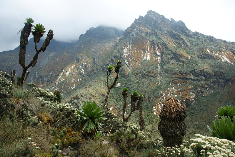
On clear mornings — and the early morning hours before the valley’s daily cloud cycle builds from the Congo Basin system to the west are the clearest of the day — Mount Stanley dominates the head of the valley with a presence that the word ‘dramatic’ is inadequate to describe. The Margherita summit ridge, the Elena Glacier catching the first equatorial sun in blue-white fragments, the great shoulders of the massif rising from the Bujuku Valley floor — all of this is visible from the hut’s upper clearing in a panorama that most guests have not fully anticipated and that the photographs they take will spend years failing to reproduce. Mount Speke to the east shows its upper flanks, the Vittorio Emanuele Peak occasionally clear. Below the peaks, the upper Bujuku Valley stretches away in a landscape of bog, giant plants, and remnant Erica forest that appears to belong to a different planet and is, in fact, one of the most biologically significant landscapes on this one.
The Morning Walk — Into the Upper Bujuku Valley
The guided morning walk from John Matte Hut ascends into the upper Bujuku Valley — the terrain that separates the hut from the Elena Glacier approach and that constitutes some of the most botanically extraordinary walking available on a non-summit Central Circuit trail Rwenzori trek. The giant Senecio forest above the hut is at its most concentrated here: dozens of the plants, many of them several meters tall and several hundred years old, arranged in the open bog and heath in configurations that have no equivalent in any other mountain environment on earth. The giant Lobelia is equally present, its spike-leaved architecture rising from the bog cushions at intervals that make the landscape look, in the low morning light, like a botanical garden designed by someone with no obligation to consult established aesthetic precedent.
The walk also accesses the lower margins of the Erica heath — the zone above the Hagenia woodland where the twisted, lichen-encrusted Erica trees grow in forms as sculptural as anything the forest below produces, their branches draped in old man’s beard that catches the cloud moisture and drips it to the sphagnum below in a continuous, barely audible rain that is the soundtrack of the upper circuit. For guests with a serious birding interest, this morning above John Matte Hut is one of the finest birding excursions available on any Central Circuit programme: the Rwenzori Turaco, the Strange Weaver, the Archer’s Robin-Chat, and multiple endemic sunbird and warbler species inhabit the Erica zone above the camp in concentrations that dedicated birders travel to Uganda specifically to encounter.
Bujuku Lake — The Optional Extension
For guests with energy and motivation after the morning walk, your guide can extend the programme to the Bujuku Lake — a high-altitude tarn sitting in the valley floor at approximately 3,962 metres, fed by glacial melt water from the Stanley and Speke Mountains above. The lake occupies a position of extraordinary visual drama in the upper Bujuku Valley: surrounded by giant Senecio, with the permanent ice of the high peaks reflected in its surface on the clearest days, it is the highest point accessible on the four-day programme and provides a genuine taste of the Rwenzori’s upper alpine zone without requiring the technical equipment of the summit approach. The extension adds approximately three to four hours to the morning walk. Whether it is attempted is assessed by your guide in consultation with the group on the morning of Day 3, based on weather conditions, group fitness, and individual inclination — it is always an option, never a requirement.
Afternoon — The Hut, the Valley, and Time
The afternoon of Day 3 belongs to the traveller rather than the programme. John Matte Hut and its immediate surroundings reward extended, unhurried attention in ways that a single overnight visit — passing through on the way to higher camps — cannot access. The giant Senecio plants change character through the afternoon light: flat, almost two-dimensional in the mid-day cloud-diffused light, they become deeply sculptural and shadow-rich in the hours before sunset when the angle of the equatorial sun drops enough to produce long shadows across the bog. The birdlife in the lower Erica heath above the camp is most active in the late afternoon. The cloud that builds around the peaks during the day occasionally breaks in the hour before dark, providing brief, dramatic views of the Stanley and Speke massifs in the last light — the kind of views that become the defining visual memory of a trip regardless of what else has been seen.
For families, Day 3 at John Matte is where the trek’s particular character becomes most fully legible to younger travelers: the freedom of having nowhere to be, the physical comfort of having already achieved something significant, and the ongoing revelation of the mountain’s natural history — the giant plants, the endemic birds, the extraordinary bog ecology — delivered by a guide whose expertise is matched by their patience and their genuine pleasure in sharing this environment with guests who are discovering it for the first time. For couples, the afternoon at John Matte carries the particular intimacy of high places where the ordinary world has genuinely receded and what remains is the company, the landscape, and the cold clean air.
The Second Evening
The second evening at John Matte Hut deepens the sense of belonging to the place that the first night established. The mountain is familiar now — not fully known, because the Rwenzori does not fully reveal itself in four days or forty — but known enough to be comfortable, to be something you have slept inside rather than merely visited. The guide is better known too, the conversation at dinner easier, the shared reference points of two days on the trail together creating the particular ease of people who have moved through difficult and beautiful country side by side. The cook’s second dinner is, if anything, received with more appreciation than the first: the altitude has suppressed appetite enough that the physical pleasure of a hot, substantial meal at 3,414 metres is more acute than it would be anywhere below.
Second overnight: John Matte Hut (3,414 m). Same accommodation as Night 2. Full dinner and breakfast included.
Day 4 — The Long Way Home: John Matte Hut to Nyakalengija
A Final Morning Above 3,000 Metres
Day 4 begins early — the descent is long and the guide prefers to have the group moving before the Bujuku Valley’s daily cloud cycle builds into the lower forest. The final morning at John Matte Hut is conducted with the specific quality of the last morning in any place that has revealed itself properly: the light noticed more carefully, the sounds attended to with more deliberateness, the peaks overhead given a longer look than they might receive if there were a tomorrow on the mountain. Tea is taken outside the hut in the early cold. Breakfast follows. Packs are assembled. And then the trail begins, downward this time, through all of the zones the ascent traversed over two days.
The Descent Through Five Botanical Worlds
The descent from John Matte Hut reverses the Central Circuit trail, but the experience is fundamentally different in direction, pace, and quality of attention. Moving downward through the Bigo Bog — the boardwalk crossings now approached from the upper end, the bog’s full extent visible below — the valley opens ahead rather than closing overhead, and the views down the Bujuku Valley corridor to the forested slopes below are a different kind of vista from anything the upward-focused ascent provided. The giant Senecio plants on the descent are passed with more leisure: the urgency of reaching the hut before the weather closes has been replaced by the more comfortable urgency of reaching Nyakalengija before dark, and the trail between them is long enough that the pace must be maintained without being rushed.
The Hagenia-Hypericum woodland, descended through in the late morning, looks different from the top: the old man’s beard lichen on the Hagenia branches illuminated from above by the cloud-diffused light, the horizontal branch structures more visible from above than from below, the whole zone more comprehensible in its architecture when moving through it with gravity rather than against it. The Kurt Schafer Bridge is crossed again from the far side — the Bujuku and Mubuku rivers at the same volume, the same cold, the same sound — and the trail climbs briefly back to Nyabitaba Camp for the rest stop and lunch that the programme provides at this point in the descent.
Nyabitaba to Nyakalengija — The Final Forest Section
From Nyabitaba, the trail descends through the bamboo zone and into the lower montane forest that opened the programme on Day 1. The cicadas are at full volume. The blue monkeys are in the same canopy sections they occupied on the ascent, or at least the same family groups are, with the same composure and the same mild curiosity. The forest floor, seen on the way down, reveals detail that the upward-focused attention of the ascent missed: the particular orchid on a particular trunk, the frog in the mossy hollow of a stream crossing, the lizard on a warm stone in the one patch of direct sunlight that penetrates the canopy at this hour and this angle.
The Nyakalengija trailhead appears in the mid-to-late afternoon — the park boundary, the UWA buildings, the red earth of the access road, your dedicated vehicle waiting exactly where it was left on Day 1. The park register is signed. The UWA trekking certificate — issued to all guests completing a full Central Circuit programme — is presented by your guide with appropriate ceremony. And then the drive back to Kasese: clean clothes, cold drinks from the cooler, the particular physical comfort of a body that has spent four days working hard in extraordinary country and is now being returned to the world of hot showers and proper beds with a load of memory that will take weeks to fully unpack.
The evening in Kasese — or an onward transfer to Queen Elizabeth National Park, to Murchison Falls, or to Entebbe for onward flights — is arranged seamlessly by your Gorilla Safaris team, the vehicle and driver confirming the next stage of the itinerary as you descend the last kilometres of the Nyakalengija access road for the final time.
What the 4-Day John Matte Hut Trek Reveals
The Giant Plants — Senecio and Lobelia in Their Natural Domain
The giant Senecio and giant Lobelia of the Rwenzori’s upper vegetation zones are the mountain’s most celebrated and most inadequately photographed natural features. Giant Senecio — Senecio adnivalis — grows to heights of four to eight metres at the altitudes accessible on the John Matte Hut programme, its rosettes of large succulent leaves arranged in spirals from a thick central stem, its dead lower leaves forming an insulating layer against the extreme temperature swings of the afro-alpine zone. Individual plants may be hundreds of years old. The giant Lobelia — Lobelia wollastonii — accompanies the Senecio in the wetter sections of the upper valley, its spike-leaved architecture rising dramatically from the sphagnum bog in configurations that seem to belong to a prehistoric landscape. Both plants are found here, at these altitudes, in these forms, only in the Rwenzori Mountains and a few other Albertine Rift locations. They are among the most biologically distinctive organisms in Africa.
The Bigo Bog — A Landscape at the Edge of Comprehension
The Bigo Bog in the upper Bujuku Valley is the Central Circuit’s most visually extraordinary and most ecologically complex feature. A vast accumulation of sphagnum moss, sedge, and aquatic vegetation in the valley’s flat floor, the bog is the result of thousands of years of glacier melt, continuous rainfall, and the particular soil chemistry of the upper Rwenzori creating conditions where organic material accumulates faster than it decomposes. The result is a living landscape of remarkable depth — sphagnum cushions several metres thick, bog pools reflecting the peaks above, giant Senecio plants standing at the bog’s margins in silhouettes that become increasingly dramatic as the light changes through the day. The boardwalks that cross the Bigo preserve the bog’s surface ecology while providing the only reliable route through it, and your guide knows every section of the crossing in every weather condition.
Central Circuit Birdlife — 217 Species in Four Zones
The 4-day Rwenzori trek to John Matte Hut programme crosses three of the Rwenzori’s four accessible trekking vegetation zones, each with its own endemic avifaunal assemblage. In the lower montane forest, the Rwenzori Turaco, multiple Sunbird species, and various forest robins and warblers define the bird character of the ascent. The bamboo zone adds the Rwenzori Apalis and Rwenzori Hill Babbler to the list. In the Hagenia-Hypericum woodland and lower Erica heath around John Matte Hut, the Strange Weaver — one of the most sought-after endemic species in the Albertine Rift — the Archer’s Robin-Chat, the African Green Broadbill, and multiple endemic sunbirds create an avifaunal concentration that serious birders travel to Uganda specifically to access. Rwenzori Mountains National Park records 217 bird species in total, with over 70 Albertine Rift endemics. Your private guide is a trained naturalist for all four days.
The Kurt Schafer Bridge — The Circuit’s Defining Crossing
The Kurt Schafer Bridge at the confluence of the Mubuku and Bujuku rivers is the Central Circuit’s most symbolically and visually significant feature on the lower circuit. Crossed twice on the four-day rwenzori trek to John Matte Hut— on the Day 2 ascent and the Day 4 descent — it marks the threshold between the mountain’s lower accessible zone and the upper circuit that leads to the giant plants, the high bog, the summit camps, and the glaciated peaks. The views from the bridge’s span — two glacier-fed rivers meeting in a forested gorge with the upper circuit visible ahead through the valley — are among the most photographed on the entire Central Circuit trail route, and the sound of the confluence is a specific and irreplaceable element of the trek’s acoustic landscape.
Related Rwenzori Trekking Itineraries from Gorilla Safaris
The 4-Day John Matte Hut Trek occupies a specific and important position in the Rwenzori Central Circuit programme spectrum: more complete than a two or three-day forest-only programme, more accessible than a summit expedition, and providing the full botanical journey through the mountain’s lower and middle zones with the gift of the extra exploration day at 3,414 metres. Understanding its neighbours in the programme range helps guests identify the version that best matches their time, ambition, and experience level.
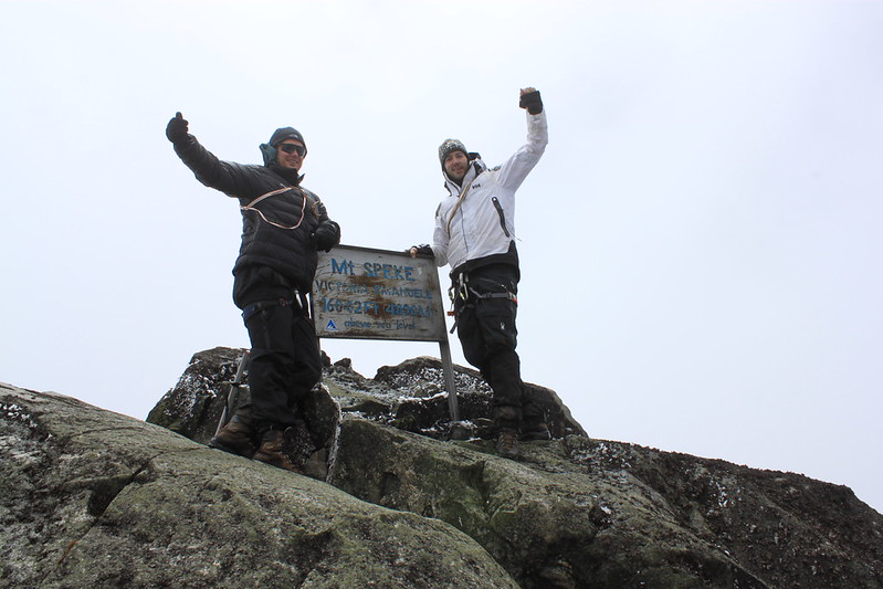
The 2-Day Lake Mahoma Trek and 3-Day Mahoma Loop Trail offer Central Circuit trail introductions via the Mahoma branch of the trail, reaching the sacred crater lake at 2,988 metres rather than the Bujuku Valley — a different ecological character and a different destination within the same park. The 4-Day Rwenzori Trek to Margherita Peak extends the John Matte Rwenzori trekking expedition by two additional days, pushing from John Matte to Elena Hut (4,541 m) and then to the Margherita summit (5,109 m) with the technical requirements of glacier travel. The 7-Day Central Circuit to Margherita Peak is the classic full summit programme, traversing all five vegetation zones with proper acclimatisation stops and the highest summit success rates of any Margherita programme. For guests wanting the complete Uganda mountain and primate experience, the 12-Day Gorilla and Rwenzori Combined Safari pairs gorilla trekking, chimpanzee tracking, Queen Elizabeth game drives, and a Rwenzori Central Circuit expedition in a single comprehensively managed private itinerary.
What to Pack for the 4-Day Rwenzori Central Circuit Trek
Boots and Gaiters — The Foundation
4 days Rwenzori trek to John Matte on the Central Circuit trail, ascending to 3,414 meters through three vegetation zones including the Bigo Bog crossing, requires waterproof, ankle-supporting hiking boots that have been properly broken in before departure. The Rwenzori’s trail surfaces are wet in all seasons — the lower forest holds moisture year-round, the Hagenia-Hypericum zone is saturated throughout, and the Bigo Bog’s boardwalk sections are surrounded by waterlogged terrain that will find any gap in boot waterproofing within minutes. Trail runners, fashion boots, and new footwear are the three most reliable paths to a four-day experience defined by blisters and wet feet rather than botanical revelation. Gaiters are strongly recommended for the John Matte programme and are available for hire through Gorilla Safaris. Please advise our team at booking so they are ready at the Nyakalengija trailhead.
Waterproofing for All Conditions
A waterproof shell jacket with a sealed hood is non-negotiable from Day 1. The Rwenzori’s weather is generated by the Congo Basin system to the west, moves rapidly, and rarely telegraphs its intentions more than twenty minutes in advance. Above the bamboo zone, the combination of altitude, cloud, and wind makes effective waterproofing a safety requirement rather than a comfort preference. Waterproof trousers are equally important from the Hagenia zone upward and essential for the Bigo Bog crossing. All base and mid-layers should be wool or synthetic — cotton loses its insulating properties when wet and creates genuine cold risk at 3,414 metres in damp conditions. A fleece or lightweight down jacket is essential for the evenings at Nyabitaba and John Matte, where temperatures drop to 8°C–14°C and 6°C–12°C respectively. A warm hat and light gloves are recommended for the John Matte evenings and early mornings.
Trekking Poles
Trekking poles are strongly recommended for all four days and particularly important for two specific sections: the Bigo Bog boardwalk crossing on Day 2, where balance across wet, sometimes uneven surfaces in cloud conditions benefits significantly from the additional contact points that poles provide, and the Day 4 descent from John Matte through the Hagenia and bamboo zones to Nyakalengija — a sustained downhill of approximately 1,764 metres that places significant cumulative load on the knees. Poles are available for hire through Gorilla Safaris if you are not travelling with your own.
Daypack Essentials for Four Days
Your porter team carries all group camping equipment and food supplies. Each trekker maintains their personal daypack for every day on the trail, which should contain: 2–3 litres of water (refillable from treated mountain sources), high-energy trail snacks for between-meal energy on the ascent days, high-SPF sunscreen and lip balm (UV intensity is significant above 2,000 m even through cloud), insect repellent for the lower forest, all personal medications including prescription items, a camera with additional batteries or charging bank (no mains electricity at either camp), a headtorch with spare batteries, a lightweight rain cover for the daypack, and a small personal dry bag for electronics and documents. A comprehensive gear list is provided to all guests at the time of booking.
What’s Included in Your 4-Day John Matte Hut Trek
Your Gorilla Safaris Central Circuit expedition to John Matte Hut is arranged as a completely supported, entirely private mountain journey. Every logistical element is confirmed before your arrival in Uganda, so that from the Nyakalengija trailhead to the final day’s descent, the mountain receives your full and undivided attention.
- All Uganda Wildlife Authority (UWA) park entry fees and Central Circuit trekking permits for all 4 days
- Professional, UWA-certified private mountain guide for the full 4-day programme
- Dedicated UWA armed ranger escort throughout all 4 days on the trail
- Experienced porter team carrying all group camping equipment, food supplies, and shared loads for all 4 days
- All meals on the mountain: hot dinner Day 1, full breakfast and packed trail lunch Day 2, hot dinner Day 2, full breakfast and guided walk snacks Day 3, hot dinner Day 3, full breakfast and packed trail lunch Day 4
- Drinking water and electrolyte supplements throughout all 4 days
- 2 nights mountain accommodation: Nyabitaba Camp (2,651 m) Night 1, John Matte Hut (3,414 m) Nights 2 and 3 — twin-share mountain huts with sleeping mats and blankets
- Basic first-aid kit and altitude monitoring throughout; guide trained in altitude illness recognition and emergency response
- UWA Central Circuit trekking certificate issued on completion
- Private vehicle transfers between Kasese and Nyakalengija trailhead in both directions
- All government taxes and statutory levies
- Comprehensive pre-departure gear list, trail briefing document, and altitude preparation guidance
What’s Not Included
For complete transparency, the following items fall outside the trek package and should be accounted for in your planning.
- International flights to Uganda (Entebbe International Airport)
- Uganda tourist visa — apply via the official online e-visa portal before travel
- Comprehensive travel and medical insurance including emergency mountain evacuation — mandatory for all trekking guests; policy must cover trekking above 3,000 m in Uganda
- Personal trekking gear: waterproof boots, gaiters, trekking poles, waterproof jacket and trousers, warm layers (full gear list provided at booking; selected items available for hire through Gorilla Safaris)
- Personal sleeping bag (recommended: rated to -5°C or below for the John Matte Hut nights)
- Guide, porter, and cook gratuities — suggested amounts provided in pre-departure information
- Personal beverages beyond included drinking water (beer, soft drinks, specialty coffee)
- Hotel accommodation in Kasese before and after the trek
- Any activities, transfers, or meals not described in this itinerary
- Personal expenditure and souvenirs
Best Time to Trek the Rwenzori Central Circuit to John Matte Hut
June to August — Uganda’s Peak Dry Season
The long dry season from June through August is the most consistently reliable period for the John Matte Hut excursions. Trail surfaces are at their firmest, the Bigo Bog’s boardwalk crossings are at their most manageable, and the chance of clear morning views from the John Matte clearing toward Mount Stanley and Mount Speke is significantly higher than in the wet season months. This is Uganda’s peak travel season, and Central Circuit permits and porter teams fill in advance — booking four to six months ahead for June–August departures is strongly recommended. The John Matte mornings in July, in particular, are consistently cited by Gorilla Safaris guides as among the finest views the Central Circuit Trail provides in any season.
December to February — The Short Dry Season
December through February offers conditions comparable to the peak season with considerably fewer trekkers on the trail. The Christmas and New Year period at John Matte Hut — the camp in cold, clear conditions, the peaks occasionally visible by starlight from the hut’s upper clearing — has a particular quality that returning guests deliberately seek out. Permits and porter teams are more readily available in this period, and the combination of dry season conditions and quiet trails makes December–February an excellent choice for groups who value a more intimate mountain experience. The combination with Bwindi gorilla trekking over the school holiday period is particularly well-managed in this window.
March to May — The Long Rains
The long rains of March to May bring the Central Circuit’s botanical character to its most vivid and most atmospheric expression. The Hagenia-Hypericum woodland is saturated and luminous, the old man’s beard lichen at its most silver and most mobile in the constant cloud moisture. The Bigo Bog is at its wettest and most challenging — the boardwalk crossings requiring careful attention and proper waterproofing — and the giant Senecio plants around John Matte Hut are surrounded by water in the bog sections, giving the whole landscape a quality of primordial completeness that the dry season cannot replicate. Birdwatching is at its annual peak during the rains, with migrants joining the endemic assemblage in numbers that make the Hagenia zone birding around John Matte particularly exceptional. For well-equipped, experienced trekkers who appreciate the mountain at its most intensely alive, the long rains season is not a compromise — it is a specific and deliberate choice.
September and October — The Sweet Spot for Families
The September–October transition period offers the 4-day Rwenzori trekking to John Matte at its most family-accessible: the vegetation freshly green from the short rains ending in October, trail surfaces firming as the dry weather establishes, temperatures comfortable throughout the ascent, and the mountain’s wildlife activity at levels that make the lower forest section particularly rewarding for younger trekkers. For families with school-age children whose October half-term provides the travel window, the 4-day Rwenzori trekking to John Matte Hut expedition— with its full exploration day on Day 3 that can be calibrated to the family group’s individual energy levels and interests — is one of Gorilla Safaris’ most frequently recommended Rwenzori trekking expeditionsfor this demographic in this season.
Frequently Asked Questions — 4 Days Rwenzori Trek to John Matte Hut
What is John Matte Hut and where is it located?
John Matte Hut is a Uganda Wildlife Authority mountain camp located at 3,414 metres above sea level in the upper Bujuku Valley on the Rwenzori Central Circuit, Rwenzori Mountains National Park, Uganda. It is named for John Matte, one of the most celebrated Bakonzo mountain guides in the Rwenzori’s trekking history, whose lifetime knowledge of the Central Circuit terrain helped establish the route that contemporary trekkers follow. The hut sits at the junction between the Hagenia-Hypericum woodland below and the lower Erica heath above, commands views up the valley toward Mount Stanley (5,109 m) and Mount Speke (4,890 m), and serves as the highest overnight point for the four-day Rwenzori trekking to John Matte Hut. It is also the first major camp on the approach to Elena Hut and the Margherita Peak summit for longer Central Circuit programmes.
How difficult is the 4-Day Rwenzori Trek to John Matte Hut?
The 4-Day Rwenzori trekking to John Matte Hut is graded moderate to challenging. Day 2 — the ascent from Nyabitaba Camp to John Matte Hut — is the expedition’s most demanding day, covering approximately 12 kilometres with an elevation gain of approximately 763 metres through three vegetation zones including the Bigo Bog crossing. Day 1 gains 1,005 metres over 9 kilometres from the Nyakalengija trailhead to Nyabitaba Camp. Day 3 involves shorter exploration walks from John Matte Hut with an optional extension toward Bujuku Lake at 3,962 metres. Day 4 is the full descent covering the Day 1 and 2 ascent routes in reverse — approximately 21 kilometres back to the trailhead. No technical mountaineering skills or specialist equipment are required. Children aged 12 and above with reasonable fitness complete the programme. Adults without prior high-altitude experience should be in good cardiovascular condition.
What is the Kurt Schafer Bridge and why is it significant?
The Kurt Schafer Bridge is a suspension bridge in the Rwenzori Central Circuit, located in the valley below Nyabitaba Camp at the confluence of the Mubuku and Bujuku rivers. It is named for a Swiss mountaineer who contributed to the development of the Central Circuit’s infrastructure. The bridge is crossed on Day 2 of the 4 days Rwenzori trekking to John Matte Hut programme during the ascent from Nyabitaba, and again on Day 4 during the descent. It is the symbolic and topographic threshold between the lower forest zone and the upper Central Circuit terrain — the point where the route transitions from the bamboo and lower montane zones of the first day to the Hagenia-Hypericum woodland and giant plant zones of the upper valley. The bridge provides the first unobstructed view up the Bujuku Valley toward the higher peaks and is one of the most photographed features on the entire Central Circuit.
What is the Bigo Bog and how difficult is it to cross?
The Bigo Bog is a large area of waterlogged sphagnum moss, sedge, and aquatic vegetation in the floor of the upper Bujuku Valley at approximately 3,400 metres on the Rwenzori Central Circuit trail . It has accumulated over thousands of years from glacier melt, continuous rainfall, and the specific soil chemistry of the upper Rwenzori, creating a living landscape of considerable depth and ecological complexity. The bog is crossed on wooden boardwalks that preserve the surface ecology while providing a route through the wettest sections. The crossing is a highlight of the Day 2 ascent and a key feature of the Day 4 descent. In good conditions with proper waterproof footwear and gaiters, the boardwalk crossing is manageable for all fit trekkers. In heavy rain conditions, the surfaces require careful footing, and trekking poles are strongly recommended for the balance advantage they provide. Giant Senecio plants stand at the bog’s margins in concentrations that make the crossing one of the most botanically dramatic sections of the entire Central Circuit.
What wildlife and birds can I expect on the 4-Day John Matte Hut Trek?
The 4-day Rwenzori trek to John Matte Hut Rwenzori Trek crosses three avifaunal and ecological zones, each with its own characteristic wildlife assemblage. In the lower montane forest: blue monkeys and black-and-white Colobus monkeys are reliable in the canopy; L’Hoest’s monkey is occasionally encountered in deeper sections; the Rwenzori Horned Chameleon inhabits the understorey. Bird species in the lower forest include the Rwenzori Turaco, multiple endemic sunbirds, African Green Broadbill, and various forest robins and warblers. In the Hagenia-Hypericum zone around John Matte Hut: the Strange Weaver, Archer’s Robin-Chat, Rwenzori Double-collared Sunbird, and Cinnamon-chested Bee-eater are characteristic species. Giant forest hog signs — tracks and rooting — are common around John Matte. The park records 217 bird species total, with over 70 Albertine Rift endemics. Your private guide is a trained naturalist for all four days of the programme.
Is the 4-Day John Matte Hut Trek suitable for families?
Yes, with appropriate preparation. The programme is recommended for families with children aged 12 and above who are physically active and comfortable with sustained hiking days of 6–8 hours. The inclusion of a full exploration day at John Matte Hut on Day 3 is particularly beneficial for families: the exploration walks can be calibrated to the group’s individual energy levels, with more ambitious members extending toward Bujuku Lake while others spend a gentler morning around the hut. The completely private guiding format means that pace, rest stops, and the daily programme are shaped entirely around the family’s needs — no group pressure, no external schedule. Many family guests describe the four-day John Matte programme as the most significant shared physical achievement of their East Africa trip.
Do I need a permit to trek the Central Circuit to John Matte Hut?
Yes. All trekking in Rwenzori Mountains National Park requires a Uganda Wildlife Authority (UWA) park entry permit, a UWA-registered and certified guide, and a UWA ranger escort for every day on the trail. These requirements apply to all Central Circuit Rwenzori expeditions regardless of destination or duration. When you book through Gorilla Safaris, all permits, park fees, guide certification, and ranger arrangements are confirmed and paid for before your arrival in Uganda. You arrive at the Nyakalengija trailhead with everything in order.
Can I see Mount Stanley and Mount Speke from John Matte Hut?
Yes — on clear mornings, which occur most reliably in the dry season months (June–August and December–February). Mount Stanley (5,109 m), the Rwenzori’s highest massif and the location of Margherita Peak, dominates the head of the Bujuku Valley above John Matte Hut and is visible from the camp’s upper clearing when cloud conditions permit. Mount Speke (4,890 m) is visible on the valley’s eastern side on the clearest mornings. The Rwenzori’s cloud system — generated by the Congo Basin weather patterns to the west — typically builds through the day and is at its densest in the afternoon and evening. The pre-dawn and early morning hours at John Matte provide the most consistent viewing windows, making the early start to Day 3’s exploration walk the programme’s recommended timing for peak photography.
What is the best time of year to do the 4-Day John Matte Hut Trek?
The June to August long dry season offers the most consistently reliable trail conditions, the firmest Bigo Bog crossings, and the best statistical chance of clear morning views from John Matte Hut toward Mount Stanley and Mount Speke. The December to February short dry season provides similar conditions with fewer trekkers. The March to May long rains produce the most botanically vivid version of the trek and the finest birding conditions, at the cost of muddier trails and more challenging bog crossings. The September–October window is recommended for families and first-time high-altitude trekkers, combining good trail conditions with comfortable temperatures and the freshly green post-short-rains vegetation.
How do I get to Nyakalengija from Kampala or Entebbe?
Nyakalengija is approximately 5 kilometres from Kasese town in western Uganda — a five-to-six-hour drive from Kampala or Entebbe on the main western highway, or under an hour by Uganda Airlines domestic flight from Entebbe to Kasese Aerodrome, with a short road transfer to the trailhead. For guests combining the John Matte Hut trek with gorilla trekking in Bwindi, the Bwindi-to-Kasese transfer takes approximately three hours through the Queen Elizabeth National Park corridor. All transfers in both directions are handled by your dedicated Gorilla Safaris vehicle and driver.
Can the 4-Day John Matte Trek be combined with a gorilla safari in Uganda?
Yes — this is one of Gorilla Safaris’ most popular itinerary combinations. The typical structure spends 2–3 days trekking mountain gorillas in Bwindi Impenetrable National Park, transfers west to Kasese via Queen Elizabeth National Park (with an optional game drive or Kazinga Channel cruise on the transfer day), and begins the John Matte Hut rwenzori trekking excursion, the following morning at Nyakalengija. The complete itinerary runs approximately 7–9 days and covers the two most extraordinary wildlife and mountain experiences that Uganda offers. Our 12-Day Gorilla and Rwenzori Combined Safari extends the combination with chimpanzee tracking in Kibale Forest and a full Queen Elizabeth game drive programme